
Drone-Mounted RF Direction Finder (DFU601)
Introduction
Today, wireless networks have served as fundamental digital infrastructure for people’s daily life and vertical industries, including LTE/5G public mobile networks, emergency command and communication networks, dedicated wireless networks for railway/broadcasting, etc. And the cornerstone of all the wireless networks is spectrum resource.
A major challenge to the networks’ normal operation is radio frequency interference, which may result in network quality degradation, significantly reduced data throughput or even service disruption. Potential sources of interference are too numerous to count, from signal jammers to networks of adjacent frequencies to unlicensed radio signals. Detecting, identifying and locating the exact position of these reference source can be expensive and time-consuming, largely depending on equipment that can be cumbersome and difficult for a person to operate efficiently in many scenarios.

In response to the challenge, we have developed a radio frequency direction finder based on drone. Since the drone supports automatic cruise flight and can easily reach the heights and areas that are unreachable for human being, the system brings not only significantly improved efficiency, but can also do many that cannot be done by experienced manpower.
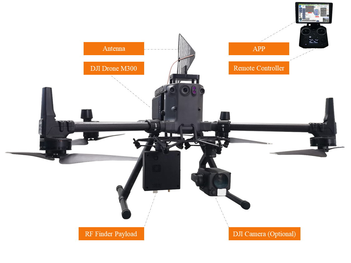
The system comprises an RF direction finding payload and an antenna which could be mounted on DJI drone M300 RTK. The payload is powered by the drone and its communication is integrated with that of the drone so that all the detection data could be transmitted to the operator in real-time. Based on DJI drone M300 RTK, the search radius can reach up to 15km. All logged data is tagged with GPS/BDS and date/time stamps as well as GPS/BDS latitude and longitude coordinates. The RF detection data is combined with map, photo and video of the real environment, which makes the interference source locating much easier.
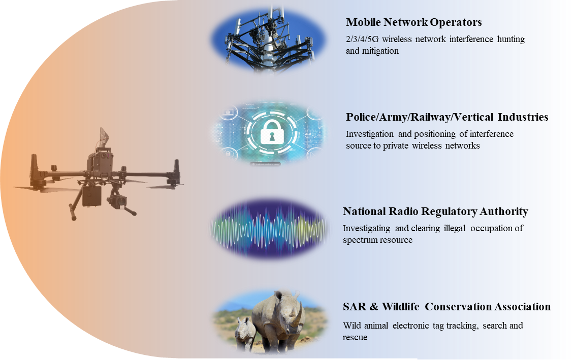
Application Scenarios
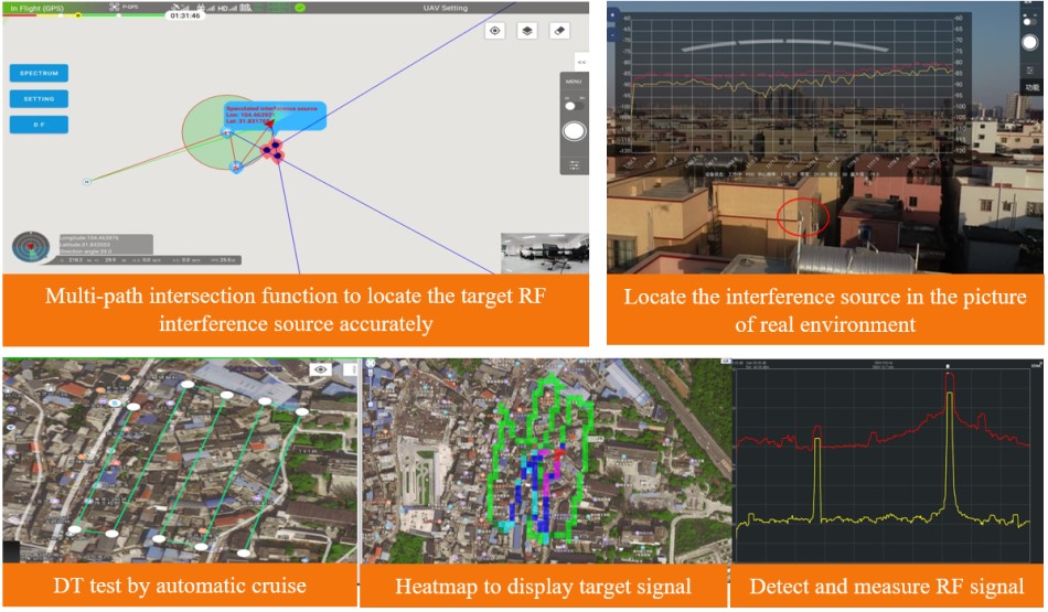
Solution Advantages

