Antenna Alignment Test Solution Based on Drone
Solution Introduction
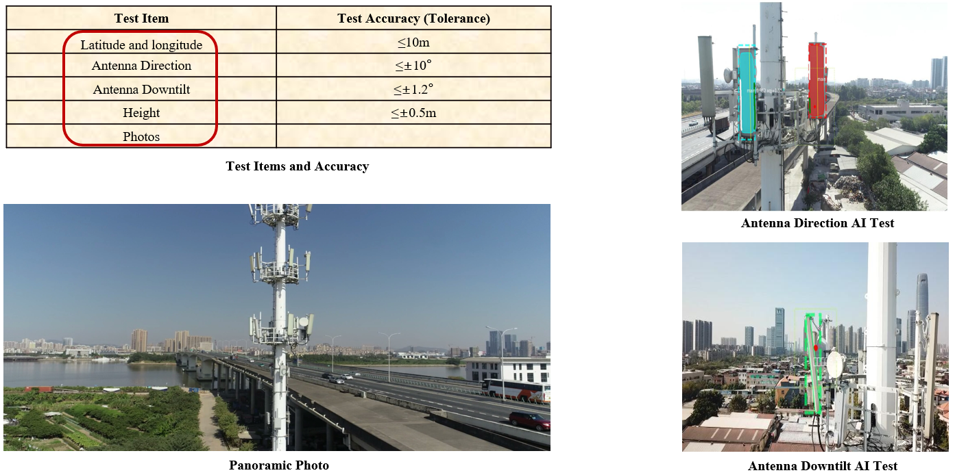
The antenna alignment test solution based on drone and AI (Artificial Intelligence) technology could automatically test multiple antenna parameters such as mechanical downtilt, azimuth, longitude, latitude, antenna height, etc. The test of a single base station takes only a few minutes. It is applicable to acceptance test of 2G/3G/4G/5G antenna installation and delivery, as well as accuracy verification of antenna database. In network planning stage, the drone-based antenna alignment tester could be used to take panoramic photos of the sites and surrounding environment from the air, and collect information such as the height of the site's antenna through AI technology. The obtained information is important for operators to formulate a reasonable network planning and construction program. The drone-based antenna alignment audit solution could be widely used in mountain stations, tower stations, lamppost stations and ordinary floor stations, which greatly improves the efficiency of network planning and acceptance test, and avoids safety risks in manual operations.
Principles of antenna alignment measurement
- Antenna downtilt calculation: use the drone to take antenna images and send back data to the server in real time; identify the real frame where the antenna is located through multi-scale detection algorithm; use antenna target segmentation algorithm to segment the real frame; adopt antenna downtilt measurement algorithm to obtain the antenna downtilt angle.
- Antenna azimuth calculation: control the drone to be at the same height as the antenna, and start taking pictures; use AI image recognition technology and the drone’s gyroscope to record relevant parameters; transmit the data back to cloud server to calculate the antenna azimuth.
- Antenna height calculation: Control the drone to fly to the same height as the antenna and take frontal shots. At the same time, the drone’s height could be read on the remote-control monitor.
Solution innovation
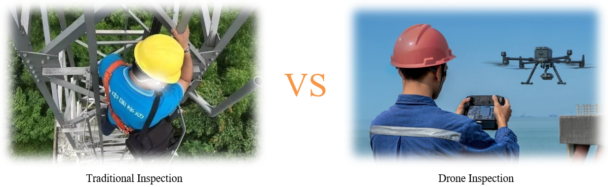
- Work mode innovation: Drone is used to replace traditional manual tower climbing survey;
- Measurement method innovation: AI measurement based on image recognition replaces traditional handheld tool measurement;
- Data management innovation: Automatic data collection and management replaces the traditional hand-written entry.
Application Scenarios
The antenna alignment test solution is applicable to acceptance test of 2G/3G/4G/5G antenna installation and delivery, as well as accuracy verification of antenna database.
It’s also applicable to network planning data collection at the initial stage of network construction. It can be widely used in various stations such as mountain station, tower station, lamppost station and ordinary floor station.
Highlights
- Reduce network construction costs. Tower rental prices tend to go up with the increase of antenna height. If the most reasonable antenna height is designed under the premise of meeting the coverage index, the insufficient coverage or investment waste caused by unreasonable construction height can be avoided, thereby reducing costs.
- Accurate and detailed data collection. Accurate antenna azimuth and downtilt can ensure that the actual coverage of the base station is the same as expected, and guarantee the operating quality of the entire network.
- Save resources and reduce risks. Using drones instead of manually climbing the tower saves tower worker resources, reduces waiting time for getting up to the station, and avoids safety risks of tower workers.
- Reduce property coordination. For some residential and commercial properties, remote survey and inspection conducted by a drone-based solution can effectively reduce the disturbance to the residents and complete the work with much less time.
Related Product:
Antenna Alignment Inspection System Based on Drone
